


 Izdanje Srbija
 Serbische Ausgabe
 Izdanje BiH
 Izdanje Crna Gora


 News
News


Government gives green light to plan of expressway from Ostruznica to Obrenovac – In four lanes at up to 100 km/h by route through three Belgrade municipalities
Source: eKapija
 Monday, 14.04.2025.
10:42
Monday, 14.04.2025.
10:42
Monday, 14.04.2025.
10:42
 Comments


The position of the corridor of the Ostruznica-Obrenovac expressway (Photo: Grad Beograd/Prostorni plan/Institut za arhitekturu i urbanizam Srbije/Screenshot)
The area covered by the Spatial Plan amounts to 6.86 hectares, whereas the length of the planned section is 14.44 kilometers. The route stretches through the territories of the city municipalities of Cukarica, Obrenovac and Surcin, including the settlements of Ostruznica and Umka, as well as the cadastral municipalities of Mala Mostanica, Baric, Mislodjin and Boljevci.
The drafting authority is the Ministry of Construction, Transport and Infrastructure, whereas the expert designer is the Institute for Architecture and Urban Planning of Serbia, in cooperation with the Institute for Roads, which prepared the Conceptual Project of the expressway.
The planned route begins at the existing Ostruznica interchange at the south bypass route of Belgrade (a part of Corridor X), continues along the existing road with a planned expansion on the right-hand side, until the intersection with the so-called old Obrenovac Road.
The route then stretches down the right-hand bank of the Sava through the settlement of Umka, where comprehensive works on the regulation of the river, the construction of an embankment and the stabilization of the landslide are planned.
Near the settlement of Baric, the route diverges from the river bank and continues through the industrial zone, all the way to the de-levelled intersection and the Obrenovac interchange on the IA-grade state road E-763.
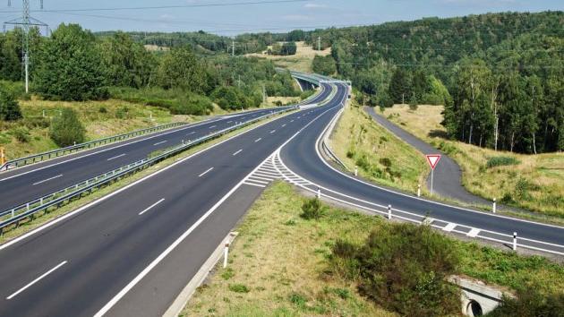
The expressway will be designed for an estimated speed of 100 km/h and have two physically separate driving lanes, each with two traffic lanes with a width of at least 3.5 meters.
The construction of eight bridges and three interchanges is planned on the route.
The Pecani semi-interchange at km 4+950 will enable a connection with the local traffic network, the settlements of Pecani, Velika Mostanica, Sremcica, as well as the old Obrenovac Road and the IIb-grade state road no. 343.
The Umka interchange at km 6+450 will connect the new traffic route with the continuation of the IB-grade state road no. 26 and the IIb-grade road no. 343.
The Baric interchange at km 13+500 connects with the IA-grade state road E-763 (through the existing Obrenovac interchange) the IB-grade road no. 26 and the Baric industrial zone.
In addition to this, nine de-levelled crossings are planned – three overpasses and six underpasses – in order to enable unobstructed traffic along the whole route.
Take a look at our Info-map of Highways and Expressways in Serbia and the Region.
I. Z.
Companies:
 Vlada Republike Srbije
 Ministarstvo građevinarstva, saobraćaja i infrastrukture Republike Srbije
 Institut za arhitekturu i urbanizam Srbije Beograd
 Institut za puteve a.d. Beograd
Tags:
Government of Serbia
Ministry of Construction Transport and Infrastructure
Institute for Architecture and Urban Planning of Serbia
Institute for Roads
Spatial Plan of the Special Purpose Area for the infrastructural corridor of the IB grade expressway from Ostruznica to Obrenovac
the river Sava
Barič
Pećani
Velika Moštanica
Sremčica
construction of expressway from Ostruznica to Obrenovac
Ostruznica Obrenovac expressway
Ostruznica interchange
corridor 10
old Obrenovac road
Umka interchange
Baric interchange
Pecani interchange
Comments
Your comment
Naš izbor


Most Important News
Full information is available only to commercial users-subscribers and it is necessary to log in.
Pratite na našem portalu vesti, tendere, investicione projekte, grantove i pravnu regulativu.
Registracija na eKapiji vam omogućava pristup potpunim informacijama i dnevnom biltenu
Naš dnevni ekonomski bilten će stizati na vašu mejl adresu krajem svakog radnog dana. Bilteni su personalizovani prema interesovanjima svakog korisnika zasebno,
uz konsultacije sa našim ekspertima.