


 Izdanje Srbija
 Serbische Ausgabe
 Izdanje BiH
 Izdanje Crna Gora


 News
News


Government decides to develop Special Purpose Area Spatial Plan for Coka Rakita ore deposit
Source: eKapija
 Sunday, 16.11.2025.
11:42
Sunday, 16.11.2025.
11:42
Sunday, 16.11.2025.
11:42
 Comments


Illustration (Photo: Africa Studio/shutterstock)
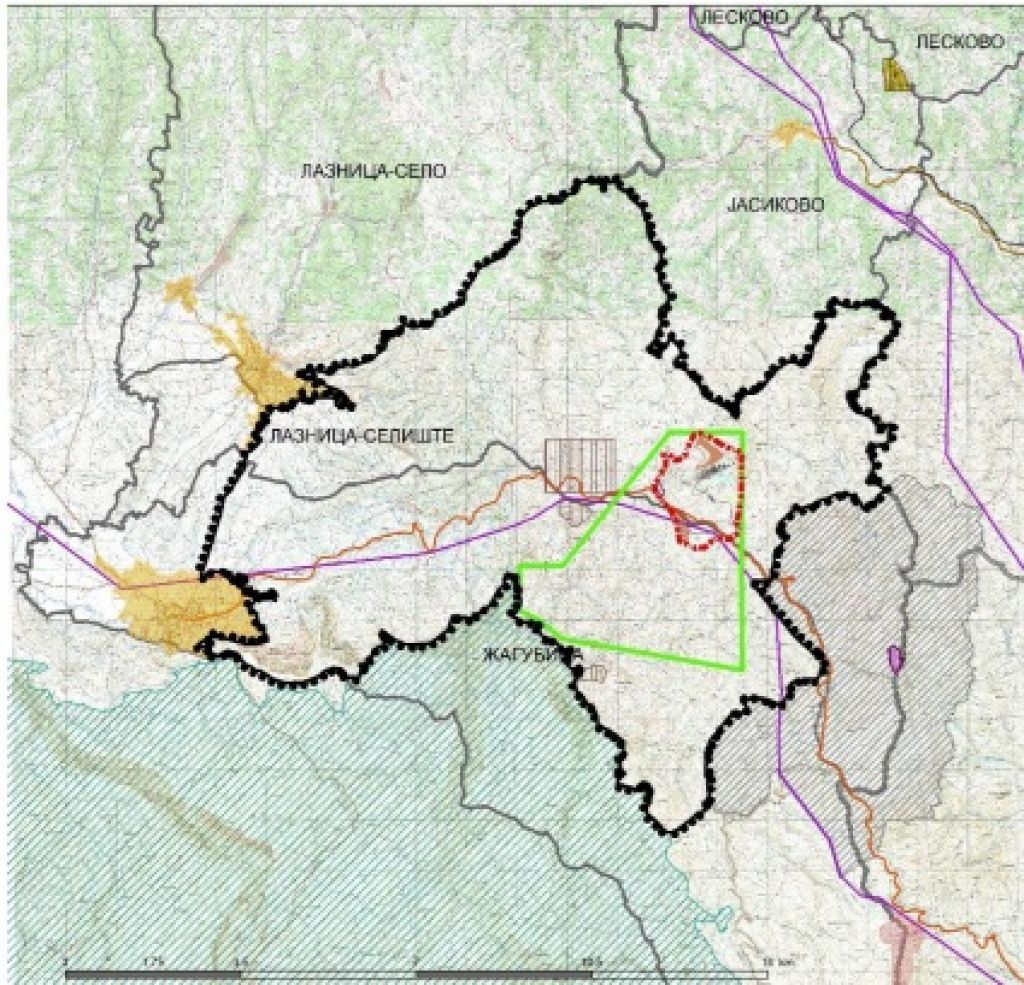
The framework boundary of the Spatial Plan covers parts of the territory of the municipality of Zagubica, namely: parts of the cadastral municipalities of Laznica – Seliste and Zagubica. The final boundary of the scope of the Spatial Plan will be determined by the Draft Spatial Plan.
– The development of the Spatial Plan is based on planning, study, technical and other documentation, the results of previous research and valid documents in the Republic of Serbia. The conceptual framework for planning, use, regulation and protection of the planning area is based on ensuring the conditions for: planned use of the area of exploitation and processing of sulfide-type ores, rational use and preservation of natural resources, protection and improvement of the environment, valorization of the area’s complementary potential for development, spatial, traffic and economic integration of the mining area with the environment, etc. – this is stated in the decision, which adds that the SPSP will contain detailed elaboration for the planned purposes.
The deadline for the development of the Draft Spatial Plan is 12 months from the date of entry into force of this decision, and the funds for the development of the plan are provided by Crni Vrh Resources d.o.o. Beograd.
The responsible party for the development of the Spatial Plan is the Agency for Spatial and Urban Planning of the Republic of Serbia.
– The Decision on the Development of the Strategic Environmental Impact Assessment of the Spatial Plan for the Special Purpose Area of the Coka Rakita Ore Deposit in the Crni Vrh Region (Official Gazette of the RS, No. 15/25) forms an integral part of this decision. For the purposes of the development of the Spatial Plan, a Study on the Protection of Immovable Cultural Property will be prepared. The draft spatial plan will be exposed for public inspection for 30 days at the headquarters of the local government unit that is within the scope of the Spatial Plan – the documentation indicates.
Let us remind that, in March this year, the Agency for Spatial and Urban Planning of the Republic of Serbia made a decision to develop a Strategic Environmental Impact Assessment of the Spatial Plan for the Special Purpose Area of the Coka Rakita Ore Deposit in the Crni Vrh region.
Let us also remind that the Canadian company Dundee Precious Metals, which has permits for the exploration of gold and other metals in the vicinity of Zagubica, published a (pre)feasibility study at the end of December last year, stating that the Coka Rakita mine could be opened in the second half of 2028. The study states that the construction of the mine should begin in mid-2026 and that the initial capital investments in opening the mine and processing gold and other metals would amount to around USD 380 million. The mine is expected to have a life cycle of 10 years, and it is estimated that 1.2 million ounces of gold, or about 34 tons, will be mined during that period.
D. A.


Fotografije:
Opis:
Vidi sve
Companies:
DPM Crni vrh doo Beograd
 DPM Avala doo Beograd
Agencija za prostorno planiranje i urbanizam Republike Srbije
Tags:
Crni Vrh Resources doo Beograd
Dundee Precious Metals
Agency for Spatial and Urban Planning of the Republic of Serbia
Coka Rakita ore site
Coka Rakita mine
Special Purpose Area Spatial Plan for Coka Rakita Ore Deposit
Investicije na lokaciji:
2025.
Comments
Your comment
Naš izbor



Most Important News
Full information is available only to commercial users-subscribers and it is necessary to log in.
Pratite na našem portalu vesti, tendere, investicione projekte, grantove i pravnu regulativu.
Registracija na eKapiji vam omogućava pristup potpunim informacijama i dnevnom biltenu
Naš dnevni ekonomski bilten će stizati na vašu mejl adresu krajem svakog radnog dana. Bilteni su personalizovani prema interesovanjima svakog korisnika zasebno,
uz konsultacije sa našim ekspertima.