


 Izdanje Srbija
 Serbische Ausgabe
 Izdanje BiH
 Izdanje Crna Gora


 News
News


Between Pozega and Arilje, two tunnels, 12 bridges and routes for speeds from 100 to 120 km/h: Green permit requested for new section of Belgrade-South Adriatic highway
Source: eKapija
 Monday, 07.09.2026.
09:13
Monday, 07.09.2026.
09:13
Monday, 07.09.2026.
09:13
 Comments


(Photo: Print screen / Zahtev o proceni uticaja na životnu sredinu)
The planned Sector III of the Pozega-Boljare highway represents a continuation of the existing IA-grade state road Belgrade-Cacak-Pozega (“Milos Veliki” highway) on the Pozega-Arilje-Ivanjica-Sjenica (Duga poljana)-Boljare (border with Montenegro) route.
As stated in the document, the section of the highway in question begins in Pozega, after the graded intersection “Prilipac”, a traffic junction that separates the two highway routes E-761 and E-763. The route then continues south, along the eastern side of the Moravica River. In the zone of the future two-way service center Arilje (~km 148+600), the route intersects with an electric power line in two places, the relocation of which will be necessary, according to the documentation. After leaving the service center zone, the highway enters the territory of the Arilje municipality. The Arilje interchange is planned in the zone of the Virovo settlement.
– Considering the need for flood control of the Moravica River, as well as the urban planning conditions, the route climbs in the Virovo and Nedeljkovici areas and enters the tunnel tubes in the zone from km 151 to km 154. After exiting the first Virovo tunnel, the route passes over a bridge structure and intersects with the IIA-grade state road no. 196 (km 151+587) as well as with the Boskovica stream. After the second Cerova tunnel, the route passes through terrain intersected by ravines with steep slopes, which is why it is planned on a series of bridge and support structures. In the zone of km 156, the route enters a cut, where the demolition of a large number of buildings is planned, as well as the construction of an overpass to connect the local road. From there, the route continues south towards the municipality of Ivanjica, where Section 2 begins. This is specified in the documentation.
On Section 1, for which the application was submitted, the vehicle speed is planned to be from 100 km/h to 120 km/h, in accordance with the previous Preljina-Pozega section and the character of the terrain within the corridor of the planned solution, which ranges from flat to hilly.
On the hilly part of the route, i.e. the one for speeds up to 100 km/h, four lanes of 3.5 m each, two stop lanes of 2.5 m each, two edge lanes of (0.50 + 0.20) m each and two shoulders of 1.5 m each and a median strip of 3 m are planned. All of this is also planned for the flat part of the route, the one for speeds up to 120 km/h, with the width of the lanes on that part being 3.75 m.
As highlighted in the document, after the Arilje interchange, the route was significantly adjusted in relation to the General Design, at the request of the Municipality of Arilje, in order to reduce the impact of the highway on the city and its development. This change resulted in a longer route and the appearance of a larger number of facilities. The route running through the hilly area west of Arilje caused the application of somewhat larger longitudinal slopes. Because of all this, it is pointed out, the route of this section of the highway is to a significant extent defined by engineering structures and facilities.
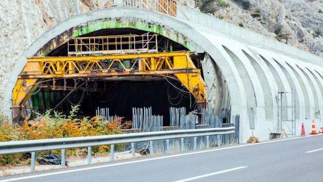
When it comes to tunnels, the width of the roadway in them will be 8 m. The tunnels will be without emergency lanes for economic reasons, the documentation states. The exact positions of the portals and the lengths of the tunnel tubes will be determined in the next design phase. The control center that will also serve this section is planned on the previous section near the Munjino Brdo tunnel.
The Virovo tunnel is planned with a left tunnel tube of 462 m and a right one of 460 m, and the Cerova tunnel with a left tube of 2,965 m and a right one of 1,940 m. In both tunnels, several SOS/road assistance niches are planned, as well as electrical niches and transverse pedestrian passages. The implementation of all fire protection measures is planned, as well as general and safety lighting.
As for bridge structures along the route, 12 are planned.
The toll station, in the zone of the graded intersection of Arilje (around km 150+300), will consist of traffic surfaces (a toll plaza with five traffic lanes and four dividing islands), an administrative building, a canopy and toll booths and elements of technical infrastructure necessary for the functioning of the toll collection system and procedures.
Traffic management centers will be established on the expansions along the highway, in the form of plazas with an adequate maneuvering traffic surface, a facility for housing electrical and telecommunications equipment necessary for the functioning of the tunnel, and, if necessary, a space reserved for the installation of supporting infrastructure systems (base station, antenna mast, etc.). The planned facilities are: tunnel operational centers, on the plaza at the entrance to the T1 tunnel (around km 151+077), as well as on the plaza at the exit from the T2 tunnel (around km 154+152), as well as a power station, on the plaza at the entrance to the T2 tunnel (around km 152+212).
An Arilje maintenance base is also planned, which will be positioned next to the roundabout through which the motorway is connected to the existing IB-grade state road no. 21.
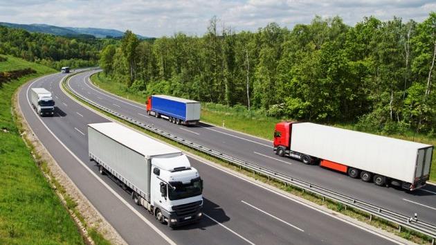
In addition to taking over transit traffic flows, the greatest importance of the planned highway, as stated, is the relocation of transit flows outside the development area of Pozega, Arilje, Ivanjica and other smaller settlements. Sections 1 and 10 represent the initial and final segments of the highway from Pozega to Duga Poljana (L=75 km), which will be implemented in phases, according to the planning and technical documentation.
D. Aleksic


Tags:
Roads of Serbia
Ministry of Environmental Protection
highway E 763
Belgrade South Adriatic highway
Požega Duga Poljana highway
Miloš Veliki highway
Požega Arilje highway section
Prilipac intersection
Comments
Your comment
Naš izbor


Most Important News
Full information is available only to commercial users-subscribers and it is necessary to log in.
Pratite na našem portalu vesti, tendere, investicione projekte, grantove i pravnu regulativu.
Registracija na eKapiji vam omogućava pristup potpunim informacijama i dnevnom biltenu
Naš dnevni ekonomski bilten će stizati na vašu mejl adresu krajem svakog radnog dana. Bilteni su personalizovani prema interesovanjima svakog korisnika zasebno,
uz konsultacije sa našim ekspertima.