


 Izdanje Srbija
 Serbische Ausgabe
 Izdanje BiH
 Izdanje Crna Gora


 News
News


Lazar's fortress to shine again - Doljevac starts work on Koprijan site, construction of sports fields and bungalows in the pipeline
 Thursday, 16.08.2012.
15:57
Thursday, 16.08.2012.
15:57
 Comments


(Koprijan)
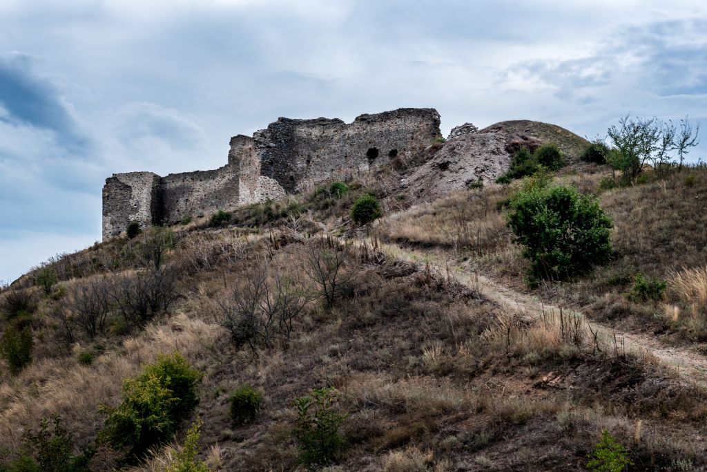
Although there are many significant historical sites on the territory of the municipality of Doljevac, the attention paid to their preservation or promotion for tourism purposes was almost insignificant until recently. This trend has finally started to change because people in Doljevac have decided to first turn the surroundings of the Koprijan fortress from the age of Duke Lazar into a picnic grounds and then to construct buildings and sports and catering facilities in its vicinity.
A hill on which the medieval town of Koprijan is situated will soon get new pedestrian trails, and all routes will be lit (from the foot of the hill to the fortress). Work on this zone is the first part of the project Development of Tourist Complex Near Medieval Town of Koprijan, which is also backed by the Ministry of Economy.
Considering that this project is to be done in a protected zone of a cultural monument, all works will be carried out in line with the conditions set by the Cultural Heritage Preservation Institute in Nis.
About RSD 18 million are required for the development of Koprijan's surroundings, that is, formation of an attractive picnic grounds, and these funds have already been secured. The project will be managed by the Doljevac Development Directorate. The municipality should provide RSD 8.5 million, whereas additional RSD 11.5 million are earmarked for that purpose in the republic budget.
Doljevac has invited tenders from contractors, so that the work on trails is expected to start very soon. All the work is to be completed within six months. In that period, the contractor is obligated to: complete all public procurements, collect all the required documentation and carry out all planned works.
Bungalows or small hotels
eKapija has talked with the town planners from PLAN Urban, who designed the Detailed Regulation Plan for the tourist complex in the vicinity of the medieval town of Koprijan, and learned that this area should be developed in the future.
(area covered by the Detailed Regulation Plan for Koprijan's surroundings)
- Our intention is to make the area of the medieval town of Koprijan and its surroundings available to tourists and picnickers. In addition to the picnic grounds, the Plan also covers the area by the South Morava river, where sports facilities will be built – our interlocutors explain.
Tourist and catering facilities will be built on an area spanning 3.81 hectares, whereas sports and recreational facilities should be constructed on an area of about 0.91 hectares.
When it comes to catering facilities, either small hotels (with up to 50 beds and accompanying amenities) or bungalows will be built.
- In case bungalows are built, the complex will consist of a main facility situated next to the road and several smaller units. It will be possible to organize various activities, such as workshops and outdoor classes, within this complex.
The Plan also defines necessary solutions for parking lots.
A green area will be built in the area nearby the South Morava river, where it is forbidden to build a facility of any kind.
Koprijan and its surroundings have always drawn the attention of tourists from the Doljevac area. If the development goes as planned, visitors from other parts of Serbia or surrounding countries will also get an opportunity to get familiar with this area.
- Part of the funds for the implementation of this project will be provided through the competent ministry, certain amount of money will come from the municipal budget, while the organization LEDIB has already contributed certain funds. Implementation will be carried out in phases, and the development of the surroundings of the medieval town will be followed by the development of the area around the river. The deadline has not been set yet and directly depends on Doljevac's investments - say people at PLAN Urban.
M.S.


 Opština Doljevac
 Ministarstvo privrede Republike Srbije
 Zavod za zaštitu spomenika kulture Niš
 LEDIB Niš
 Plan Urban d.o.o. Niška Banja
 Kurvingrad